How Drone Inspections Save Arizona Builders Time and Money
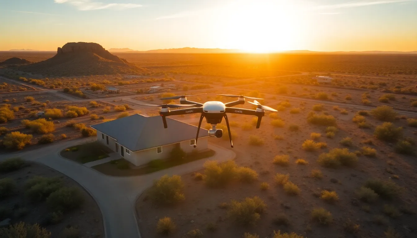
Arizona's construction industry moves fast. Desert heat limits daylight hours, monsoon season compresses schedules, and project budgets are already razor-thin before your crews burn through overtime on traditional inspection methods. Drone inspections change the equation—not because they're trendy, but because they compress timelines and cut costs in measurable ways.
Stronghold Precision Aerials works with general contractors, project managers, and developers across Southern Arizona. We've logged enough flight hours on active job sites to know exactly where drones save you money and where they save you time. This post walks through the concrete numbers.
The Real Cost of Ground-Based Inspections
Traditional site inspections require your crew lead, safety officer, or third-party inspector to physically walk the project, climb scaffolding, access roofs, or use lifts to reach high points. In Arizona's climate, that means early-morning starts to beat the heat, or acceptance that mid-day inspections happen in 110°F+ conditions.
What does that cost you?
Labor hours. A two-story residential project or a mid-size commercial structure can demand 4–8 hours of on-site inspection time. That's your crew lead off the job, your safety officer tied up, or an outside inspector billing you by the hour. Multiply that across weekly or biweekly inspections—standard practice for construction progress documentation—and you're looking at 50–100+ billable hours per project cycle.
Equipment rental. If you need scissor lifts, boom lifts, or scaffolding access to inspect upper floors, roof conditions, or exterior cladding, you're renting. Lift rental in Arizona runs $200–$500 per day. A single inspection requiring lift access costs you $300–$800 in equipment alone, before operator time.
Safety exposure. Fall hazards, heat-related illness, and equipment operation incidents drive your insurance premiums and create liability. Ground-based inspections on active construction sites introduce risk that drone-based documentation eliminates.
Schedule compression. In Arizona's climate, inspections often get pushed to early morning or late afternoon to avoid peak heat. That compresses your available inspection window and creates bottlenecks when you need rapid progress documentation for client meetings, lender reviews, or insurance claims.
How Drone Inspections Compress Timeline
A drone inspection of the same two-story residential or mid-size commercial project takes 45 minutes to 90 minutes from arrival to departure. Your crew doesn't stop work. No lifts. No safety standdowns. No heat exposure.
Here's what changes:
Parallel operations. While your crews continue framing, mechanical rough-in, or exterior work, the drone captures comprehensive aerial documentation. No crew downtime. No schedule interruption.
Same-day turnaround. Drone imagery and orthomosaic mapping can be processed and delivered within 24 hours. You get progress photos for your client meeting tomorrow morning, not next week. Lenders, architects, and general contractors reviewing project status get real-time visual proof of progress—no guessing, no delays waiting for a third-party inspector to schedule a site visit.
Multiple angles, one flight. A traditional walkthrough captures what your inspector sees at ground level. A drone flight captures roof conditions, foundation work, site layout, equipment staging, safety compliance (fall protection, PPE, housekeeping), and exterior progress in a single 30-minute flight. You get more data faster.
Heat-independent scheduling. You're not waiting for cooler hours or pushing inspections into low-light conditions. A drone flight happens on your schedule, regardless of temperature. That matters in July in Cochise County.
Orthomosaic Mapping and Progress Documentation
One of the highest-value applications for construction drones is orthomosaic mapping—stitched aerial imagery that creates a scale-accurate, top-down view of your entire project site.
For general contractors managing multiple subcontractors, this becomes your single source of truth for site progress. You can overlay orthomosaics from Week 2, Week 4, and Week 8 to show material staging progression, foundation curing schedules, framing advancement, and exterior envelope closure. No arguments about "where we were supposed to be"—the imagery is dated, geotagged, and measurable.
Cost savings from orthomosaic documentation:
- Reduced rework. Visual proof of completed work phases prevents disputes between GC and subs. No more "I thought you finished the electrical rough-in"—the orthomosaic shows exactly what's done.
- Faster change-order resolution. When a scope change or site condition issue emerges, you have dated aerial documentation showing the site condition before and after the change. Negotiations move faster when both parties are looking at the same visual evidence.
- Lender and investor confidence. Construction lenders and equity partners want to see progress. Orthomosaic maps with weekly updates prove advancement without requiring site visits. That confidence translates to faster funding releases and smoother project cash flow.
Roof Inspections and Thermal Imaging
For residential and commercial projects, roof inspections represent a specific high-value drone application. Once your roof deck is in place but before final inspection, a drone thermal inspection identifies moisture intrusion, insulation gaps, and installation defects that ground-level visual inspection misses.
Arizona roofs take a beating. Summer heat cycles create expansion stress, and monsoon season drives water infiltration. Catching roof problems before the warranty period begins saves you callbacks, warranty claims, and customer disputes.
Drone thermal roof inspection costs: - Stronghold Precision Aerials charges $400–$800 for residential thermal roof inspections, depending on square footage and complexity. - Traditional rope-access roof inspection by a third-party inspector: $1,200–$2,500. - Lift rental for roof access: $300–$500 per day.
A drone thermal inspection catches the same defects—moisture pockets, missing insulation, fastener issues—at a fraction of the cost and zero safety exposure.
Real-Time Safety Compliance Documentation
Arizona's heat, dust, and construction density create safety challenges. OSHA citations for fall protection, PPE compliance, and housekeeping issues are common. Traditional site inspections document safety at a single moment in time.
Drone footage gives you continuous, dated visual record of site conditions. You can pull orthomosaics and video from specific project phases to prove compliance, identify training gaps, or defend against citations. That documentation is also valuable for insurance claims if a jobsite incident occurs—you have visual proof of conditions and safety protocols at the time of the incident.
Equipment and Staffing Efficiency
Using a professional drone service (rather than buying a drone and training internal staff) eliminates equipment capex and ongoing maintenance costs.
In-house drone program costs: - Aircraft: $2,500–$8,000 (DJI Matrice or Freefly equivalent) - Training and Part 107 certification: $1,500–$3,000 per pilot - Software licensing (orthomosaic processing, thermal analysis): $500–$2,000 annually - Maintenance and replacement: $1,000–$2,000 annually - Pilot time: labor cost for every inspection
Outsourced drone inspection (Stronghold Precision Aerials): - Per-inspection cost: $400–$1,200 depending on scope - No equipment ownership - No training or certification overhead - Deliverables ready within 24 hours - FAA Part 107 compliance built in
For most Arizona GCs, outsourcing makes financial sense unless you're running 100+ inspections annually across a large portfolio.
Faster Decision-Making and Client Communication
Construction delays often stem not from work delays but from information delays. Your project manager doesn't know the concrete foundation is cured until the inspector visits. Your client doesn't see progress until the next scheduled walkthrough. Your architect doesn't review framing until the set of photos arrives via email three days later.
Drone inspections collapse that information lag. You have aerial imagery the same day. Your client sees progress in real-time. Your architect can review framing geometry and accuracy from their office. Your lender sees proof of advancement for the funding release meeting.
That speed compounds across a project. Decisions get made faster. Corrections happen faster. Schedule delays shrink.
Getting Started with Drone Inspections
If you're managing construction projects in Arizona, drone inspections should be part of your standard documentation workflow. The cost is low, the timeline benefit is immediate, and the documentation quality exceeds ground-based methods.
Stronghold Precision Aerials specializes in construction progress monitoring, orthomosaic mapping, 3D modeling, and aerial documentation for projects across Southern Arizona. Our FAA Part 107-certified pilots work with general contractors, developers, and project managers to deliver progress documentation on your schedule—no delays, no safety exposure, no equipment rental overhead.
We handle residential projects, commercial developments, heavy civil work, and industrial sites. We deliver orthomosaics, thermal inspections, 3D models, and progress video. We understand Arizona's construction calendar and can schedule inspections around your crew's workflow.
Contact us today to discuss how drone inspections can improve efficiency, reduce costs, and accelerate decision-making on your next project. Call for same-week availability or submit a project inquiry to get a quote.
Ready to Get Aerial Services?
Stronghold Precision Aerials delivers professional drone services for agriculture, real estate, infrastructure, and more throughout Southern Arizona. Every project is handled with precision and attention to detail.
Contact SPA for a ConsultationMore from the Blog
Vineyard NDVI Scanning in Willcox AVA: What Growers Actually See in the Data
DronesUS Aerial integration: St. Pete Police Department launches Drone Hive
Officers now have a rooftop Drone Hive at their disposal, which allows them to use cutting-edge technology as additional first responders. The three drones, controlled by pilots inside SPPD’s new Real Time Intelligence Center (RTIC), can provide quicker response times for high-priority calls. On-
ConstructionHow Drones Are Transforming Construction Progress Monitoring in Southern Arizona
Discover how drone-based construction monitoring saves Arizona builders 50-70% on surveying costs. Learn about orthomosaic mapping, 3D modeling, and real-time progress documentation for your next project.
InspectionsDrone Roof Inspections in Arizona: Safer, Faster, and More Affordable
Discover how drone roof inspections save Arizona homeowners and businesses thousands on repairs. See thermal imaging benefits, cost comparison, and why insurers recommend UAV inspections.
AgricultureWhy Arizona Vineyards Need Drone NDVI Scanning
Discover how NDVI scanning helps viticulturists in the Willcox AVA detect water stress, optimize irrigation, and maximize yields in Arizona's unique wine country.
Real EstateAerial Photography for Real Estate: How Drones Sell Properties Faster
Discover why aerial drone photography is becoming essential for real estate marketing, including statistics on faster sales, higher prices, and how to build an effective drone package.
Industry GuideHow to Hire a Professional Drone Pilot in Arizona: What to Look For
Not all drone operators are created equal. Learn the 7 essential things to check before hiring a drone pilot for your next project in Southern Arizona.
Real EstateReal Estate Aerial Photography Pricing: What Agents and Sellers Should Know in 2026
How much does real estate aerial photography cost? A complete pricing breakdown for drone photography packages, what affects cost, and why aerial imagery delivers 3-15x ROI for property listings in Arizona.
ConstructionDrone Photography for Construction Sites: A Complete Guide to Aerial Documentation in Arizona
How construction companies in Arizona use drone photography for site documentation, stakeholder reporting, marketing, and safety compliance. Learn what to expect, what it costs, and how aerial imagery saves time and money on every project.